.svg)


Get a Demo
EUDR Guides
·
May 12, 2025

Written by
Caroline Busse

The maximum 25 MB per due diligence satatement (DDS) allows for the declaration of approximately 1 million geolocation points or polygon vertices.
One DDS can therefore contain:
In case the DDS exceeds the size limit of 25 MB, there are multiple ways to decrease the GeoJSON file size:
Gather precise geolocation data of the production areas and limit the usage of ‘declaration in excess’ to a minimum.
Provide point data instead of polygons for plots smaller than four hectares.
.png)
Note: this is only advised if the DDS exceeds 25 MB and if the plot can be approximated through a point. In general, polygons offer more accurate mapping than single points.
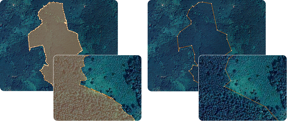
Reduce the level of detail of a polygon by only marking significant corner points instead of mapping a point every x meters.

Avoid data quality issues that add unnecessary points to the polygon, such as spikes, self-intersections or slivers.
CEO
.svg)
Caroline is an experienced data scientist with a management degree from TU Munich and a degree in earth observation from the University of Würzburg, which is co-chaired by the German Aerospace Center (DLR). She has worked as a data scientist in the areas of nature conservation and land use change monitoring at WWF, the German Centre for Integrative Biodiversity Research (iDiv), and at tech companies such as Celonis and Deloitte.


