.svg)


Get a Demo
Under the EUDR, the geolocation of all plots of land where the relevant commodities were produced needs to be gathered. This is the key requirement without which further due diligence cannot be performed. Besides deforestation and legality issues, incorrectly mapping the plot can also lead to non-compliance under the EUDR.
It is often said that the geodata collection is the easiest and most trivial part of EUDR due diligence.
But geodata collection should not be taken lightly. Mapping needs to be performed carefully, and the produced polygon and point geodata need to be checked and verified to detect and address potential issues.
The EU Information System TRACES rejects geodata within a due diligence statement if it contains certain issues.
But even if the due diligence statement can be submitted to TRACES without raising any issues, EU member state competent authorities might flag batches if they detect issues within the linked geodata.
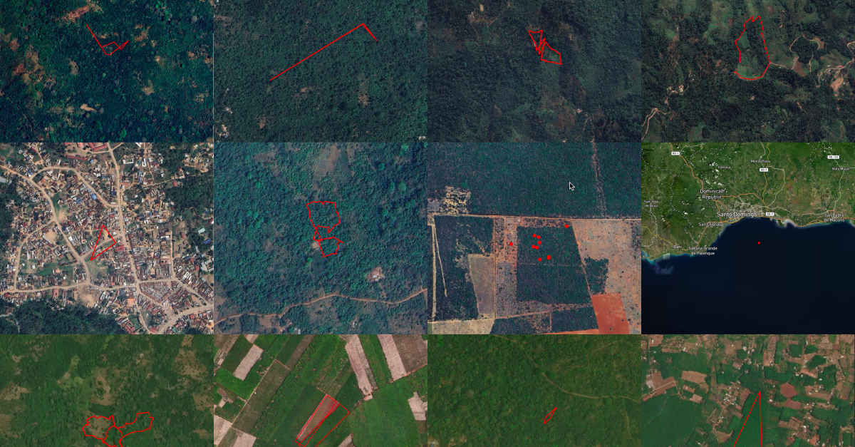
If the plots are ...
They are NOT accurately mapped.
Geodata needs to be checked during the first steps of due diligence to have sufficient time to address and correct issues in collaboration with suppliers. Any further due diligence needs to be based on a solid data foundation. Once the due diligence statement is submitted and the shipment is on its way, it's likely too late for any adaptations.
At Nadar we can support you in mapping your farm plots with our EUDR-adapted mapping and verification tools. We ensure critical issues in data quality are detected early on and only standardized geolocation data is submitted to TRACES.

CEO
.svg)
Caroline is an experienced data scientist with a management degree from TU Munich and a degree in earth observation from the University of Würzburg, which is co-chaired by the German Aerospace Center (DLR). She has worked as a data scientist in the areas of nature conservation and land use change monitoring at WWF, the German Centre for Integrative Biodiversity Research (iDiv), and at tech companies such as Celonis and Deloitte.


.png)


